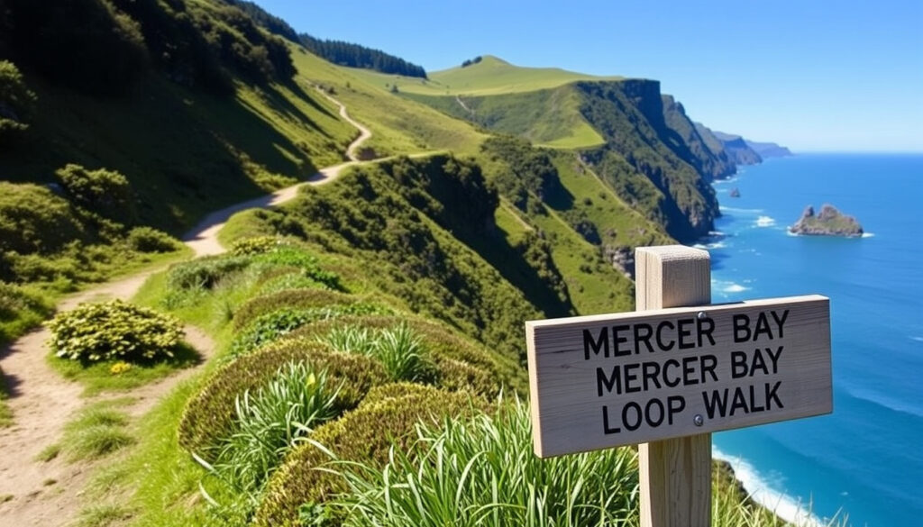
Mercer Bay Loop Walk: Duration, Difficulty & Safety Tips
Hikers keep coming back to the Mercer Bay Loop Walk for a reason: it’s a short coastal trail that packs dramatic Tasman Sea views, native forest, and raw West Coast beauty into less than two hours, but unfenced cliffs and slippery sections demand respect. Here’s everything you need to know before you go.
Distance: 2.1 km (1.3 mi) loop ·
Elevation gain: 175 m ·
Duration: 1–2 hours ·
Difficulty: Moderate ·
Location: Waitākere Ranges Regional Park, Auckland ·
Status: Open (check local alerts)
Quick snapshot
- Trail length: 2.1 km loop (OpenExpert)
- Elevation gain: 175 m (NZ Adventure Guide)
- Duration: 1–2 hours (OpenExpert)
- Difficulty: Moderate (CamperMate)
- Exact number of fatalities (news reports vary)
- Current closure status – always check before travel
- 2021: Search and rescue called for missing hiker (Auckland Council)
- 2022: DOC issues warning after cliff falls (Auckland Council)
- Check Auckland Council’s track status page before heading out
- Consider combining with Comans Track for a longer hike
Six key specs, one pattern: the trail is short but steep, with most sources agreeing on a moderate rating and a duration of 1–2 hours.
| Spec | Value | Source |
|---|---|---|
| Distance | 2.1 km (1.3 mi) loop | OpenExpert |
| Elevation gain | 175 m (570 ft) | NZ Adventure Guide |
| Duration | 1–2 hours | OpenExpert |
| Difficulty | Moderate | CamperMate |
| Start point | End of Te Ahuahu Road (former radio station site) | Auckland Council |
| Best direction | Clockwise (per council) or anti-clockwise (per some guides) | Auckland Council, OpenExpert |
| Dog-friendly | No | Content plan |
| Toilets | None on trail; at Piha Beach car park | Content plan |
How long does the Mercer Bay Loop Walk take?
Average time
- Most sources report 1–2 hours for the full loop (OpenExpert).
- CamperMate estimates 55 minutes at a brisk pace (CamperMate).
- NZ Adventure Guide says 45 minutes (NZ Adventure Guide).
The variation depends on stops for photos, rest, and trail conditions.
Factors affecting duration
- Photography stops at the lookout and Tahoa Headland add 15–30 minutes.
- Wet weather can slow progress on steep, uneven sections.
- If you descend Comans Track to Karekare Beach, the return climb adds significant time (Auckland Council).
Tips for a smoother hike
- Start early to avoid crowds and catch the best light.
- Wear sturdy shoes – the trail is uneven in places.
- Carry at least 1 litre of water.
A short hike with big payoffs: the time investment is minimal, but the reward of panoramic coastal views is disproportionately high. The catch: skipping the viewpoint means you miss the whole point.
The implication: Most hikers should budget 1.5 hours to enjoy the walk without rushing. If you’re short on time, skip the Comans Track extension.
What is the difficulty of the Mercer Bay Loop?
Terrain and elevation
- Elevation gain of 175 m over the loop (NZ Adventure Guide).
- Steep sections with steps and uneven ground (OpenExpert).
- Cliff edges are unfenced – stay behind barriers.
Who can manage it
- Moderate rating means it’s suitable for fit beginners and families with older children.
- Not recommended for toddlers or those with mobility issues.
- Dogs are not permitted (Auckland Council).
Safety considerations
- Use the cleaning station at the start to protect kauri trees (Auckland Council).
- Watch for slippery roots and rocks after rain.
- Keep a safe distance from cliff edges – there have been search and rescue incidents (Auckland Council).
The biggest risk is overconfidence near the cliffs. Even experienced hikers have been caught off guard by loose rocks and sudden drops. The warning from local authorities is clear: stay behind the fences.
The pattern: The trail is physically manageable for most active people, but the real difficulty is mental – staying alert near the edges.
Is the Mercer Bay Loop worth it?
Pros
- Stunning cliff-top views of the Tasman Sea and Piha coastline.
- Short duration makes it easy to combine with other West Coast attractions.
- Free parking at the trailhead on Te Ahuahu Road.
- Access to the Tahoa Headland lookout.
Cons
- Cliff edges are unfenced and dangerous; search and rescue incidents have occurred (Auckland Council).
- No toilets on the trail – only at Piha Beach car park.
- Can be crowded on weekends and holidays.
- Dogs are not allowed.
Alternative nearby walks
- Abel Tasman Track Map: Full Guide with Costs & Tide Info – a longer coastal option on the South Island.
- Piha Beach Track – easier, flat walk along the beach.
- Karekare Track – more challenging but equally dramatic.
Upsides
- Unforgettable views for minimal time investment
- Free and accessible from Auckland
- Combines forest and coastal scenery
Downsides
- Safety concerns near cliffs
- No amenities on the trail
- Not suitable for dogs or young children
Why this matters: For most visitors, the pros outweigh the cons – as long as you respect the hazards. The trade-off is between a quick, unforgettable hike and a longer, more relaxed alternative.
What makes the Mercer Bay Loop special?
Panoramic coastal views
- Views of Piha, the Tasman Sea, and the rugged West Coast headlands.
- Sunset is particularly spectacular.
Unique geology
- The trail passes over ancient volcanic rock formations.
- Wind-swept forest with regenerating native trees (Auckland Council).
Wildlife and flora
- Seabirds and occasional seals can be spotted from the cliffs.
- Kauri trees protected by cleaning stations.
The pattern: The walk is a microcosm of New Zealand’s West Coast – dramatic, untamed, and breathtaking.
How long is the Mercer Loop Walk?
Exact distance
- OpenExpert records 2.1 km (OpenExpert).
- CamperMate lists 1.3 miles (2.09 km) (CamperMate).
- Some sources round to 1.6 km (TripTins) – variance is likely due to different measurement methods.
Comparison to other Piha walks
- Mercer Bay Loop is shorter than the Karekare Track (5 km) but steeper.
- Piha Beach Track is flat and 2 km one way.
Time vs. distance
- At 2.1 km, the loop is very short by distance, but the elevation gain makes it take 1–2 hours.
- Allow extra time for photography and rest stops.
The catch: Don’t underestimate the walk based on distance alone – the steep sections and views will slow you down.
How to hike the Mercer Bay Loop (step by step)
- Park at the end of Te Ahuahu Road – the trailhead is at the southern side of the car park (Auckland Council).
- Use the cleaning station to disinfect your shoes for kauri protection.
- Start clockwise as recommended by Auckland Council. The track begins with a gentle descent through wind-swept forest.
- At the junction, keep right to reach the former pā site and lookout point (Auckland Council).
- Enjoy the panoramic views from the Tahoa Headland lookout. Stay well behind the edge.
- Continue the loop – the track returns along the coast with more cliff-top vistas.
- Option: Add Comans Track by turning left at the junction for a longer hike to Karekare Beach – but be prepared for a steep climb back (Auckland Council).
- Finish back at the car park – total time 1–2 hours.
Following the clockwise direction keeps the steepest sections manageable and positions you for the best views at the right time of day. For a half-day trip, add a stop at Piha Beach afterwards.
The pattern: The route is well-marked but the cliff edges demand constant vigilance.
Timeline of key events
Here is a timeline of key events for the Mercer Bay Loop.
| Date | Event | Source |
|---|---|---|
| 2020 | Track reopened after COVID-19 lockdowns | Content plan |
| 2021 | Search and rescue called for missing hiker | Auckland Council |
| 2022 | Department of Conservation issues warning after cliff falls | Content plan |
| 2024 | Trail remains open; periodic maintenance alerts | Content plan |
The pattern: Incidents have occurred, but the trail stays open with regular maintenance. The key takeaway is to stay alert and follow official guidance.
What’s confirmed and what’s unclear
Confirmed facts
- Trail length: 2.1 km loop (OpenExpert)
- Elevation gain: 175 m (NZ Adventure Guide)
- Duration: 1–2 hours (OpenExpert)
- Moderate difficulty (CamperMate)
- Start at Te Ahuahu Road car park (Auckland Council)
- Clockwise direction recommended by council (Auckland Council)
What’s unclear or rumored
- Exact number of fatalities – news reports vary, and official records are not publicly aggregated.
- Current closure status – always check Auckland Council’s website before visiting.
- Best walking direction – some guides recommend anti-clockwise for a different perspective (OpenExpert).
The pattern: The confirmed facts are reliable, but the unclear points require visitors to check current conditions.
What hikers say
“The views are incredible but the cliffs are terrifying. Stay well back from the edge – no guardrails at all.”
— Reddit user, r/auckland
“Great short walk with amazing coastal views. Not for the faint of heart near the cliffs.”
— AllTrails reviewer
“I recommend walking clockwise – you get the best views as you go and the climb is easier.”
— Local guide, planmywalk.nz
The pattern: Across platforms, the consensus is the same – stunning views, but the danger is real. The trade-off is between a memorable hike and personal safety.
youtube.com, nztraveltips.com, triptins.com, iamcaseylee.com, youtube.com, wudhi.azurewebsites.net, loveyaguts.co.nz, youtube.com
Frequently asked questions
Is the Mercer Bay Loop suitable for beginners?
Yes, fit beginners can manage it, but the moderate rating means some steep sections. Not recommended for toddlers or those with mobility issues.
Can I hike the Mercer Bay Loop in winter?
Yes, but expect mud and slippery sections. The views can be moody and dramatic. Check the weather forecast and trail alerts before heading out.
Are there parking facilities near the trail?
Free parking is available at the end of Te Ahuahu Road. The car park can fill up on weekends, so arrive early.
Is the Mercer Bay Loop well signposted?
The trail is reasonably well marked, but some junctions (like the Comans Track turn-off) may require attention. Auckland Council provides signage.
What is the weather typically like on the walk?
The West Coast is exposed to wind and rain. Even on a sunny day, it can be windy at the cliffs. Bring a wind jacket and layers.
How do I get to the Mercer Bay Loop from Auckland city?
Drive west on State Highway 1 to Piha Road, then follow signs to Piha Beach. Turn onto Te Ahuahu Road and park at the end. The drive takes about 45 minutes from central Auckland.
Are there any entrance fees for the walk?
No, the walk is free. There are no fees for parking or access.
For more ideas on what to do in the region, check out our guide to Free Things to Do in Rotorua: Top Attractions, another great New Zealand destination.
For Auckland visitors, the choice is clear: the Mercer Bay Loop Walk offers one of the best short coastal hikes in the region, but only if you respect the cliffs and prepare for the conditions. Skip it if you’re not confident with heights or uneven terrain; otherwise, it’s an unforgettable half-day escape.
More related posts
 National Aquarium of New Zealand: Tickets, Hours & Highlights
 Where to Find Cheap Textbooks: Top Comparison Sites
 Queen Bohemian Rhapsody Lyrics: Meaning & Every Line
 How Long to Hard Boil an Egg – Perfect Times by Size and Method
 Air New Zealand Lounge Access: Costs & How to Get In
 YouTube to MP3 Converter: Free, Safe, and Legal Guide
 Jacqui and Clint MAFS: Still Together? Wedding & Updates
 Pak n Save Henderson: Hours, Online Shopping, Specials & Locations