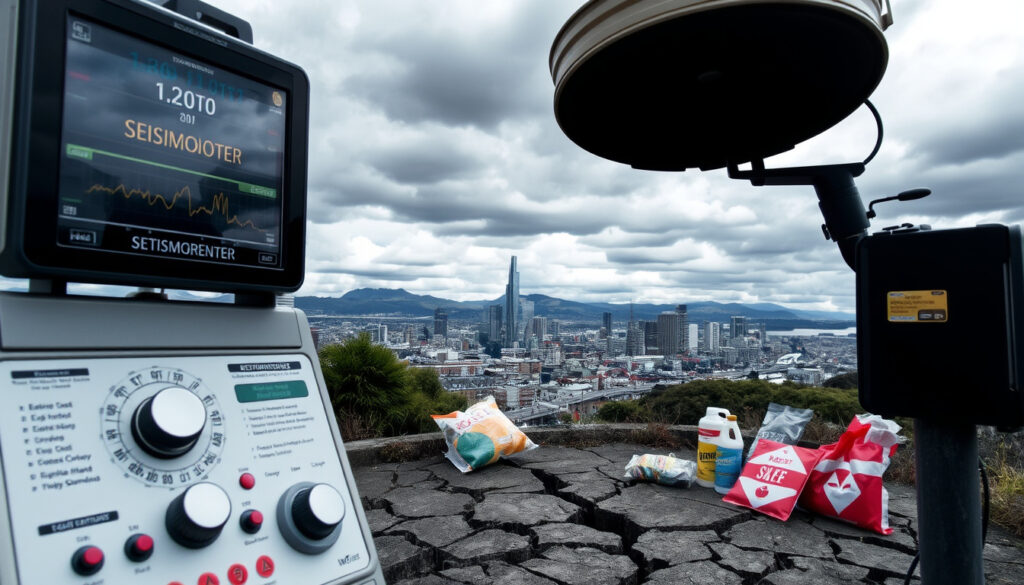
Earthquake Wellington Just Now Live: Track & Prepare
If you’re in Wellington and felt the ground shake, you’re not alone – the city sits on one of New Zealand’s most active fault systems, meaning small tremors are a regular part of life here. This guide combines live monitoring tools from GeoNet with expert-backed safety steps, so you can check what just happened, understand the risk beneath your feet, and know exactly what to do next.
Magnitude of latest felt Wellington earthquake: Check live GeoNet feed ·
Annual earthquakes recorded in NZ: ~20,000 ·
Wellington Fault rupture probability: 5-10% in next 50 years ·
Highest recorded NZ earthquake magnitude: Mw 8.2 (Wairarapa, 1855) ·
Wellington tsunami risk level: High (local and distant sources)
Quick snapshot
- GeoNet: Weak and above earthquake list – official real-time data.
- Wellington Quake Live: Community-aggregated sensor data.
- News Wire: Fast-updating national map (NZ Herald).
Five key data points that define Wellington’s seismic reality, from the latest shake to the long-term odds:
| Label | Value |
|---|---|
| Latest Wellington Earthquake | Live data from GeoNet weak and above list |
| Primary Risk Source | Wellington Fault + Alpine Fault system |
| Tsunami Risk Level | High for local and distant-source waves |
| Highest Recorded Local Magnitude | 8.2 Mw (Wairarapa, 1855) |
| Key Preparedness Drill | Exercise Rū Whenua 2024 |
Was there an earthquake in NZ just now?
If you felt a sudden jolt or a rolling sensation, the quickest way to confirm an earthquake is to check New Zealand’s official monitoring service. GeoNet (New Zealand’s official earthquake monitoring network) publishes a live “Weak and above” list that updates in real time with magnitude, depth, and location. For example, a magnitude 4.6 event was logged at 2:26 PM on Fri Jul 17 2026 on that very page, and a 4.2 magnitude quake about 25 km southwest of Wellington in May 2026 (NZ Herald) generated nearly 6000 felt reports.
How to use the GeoNet live earthquake map for Wellington
The GeoNet “Weak and above” list shows only quakes that have been felt or have caused minor concern. For a broader view, the full earthquake map includes all recorded events, even tiny ones. Third-party tools like Quake Live (GeoNet Facebook updates) aggregate GeoNet data and add community-reported felt experiences. Pay attention to depth: a 22 km deep quake like the May 2026 event tends to be felt widely but cause less damage than a shallower one.
What the map tells you about the latest earthquake’s location and strength
The map centres on a pin showing the epicentre. Coloured circles indicate magnitude: green for small (M2-3), yellow for moderate (M4-5), red for strong (M5+). The “felt reports” counter tells you how many people submitted an experience. A March 2025 magnitude 4.3 quake 5 km southwest of Wellington (NZ Herald), for instance, was categorised as moderate and triggered hundreds of felt reports by 7:24 AM.
How big was the Wellington earthquake?
Magnitude measures the energy released at the source. Intensity, measured on the Modified Mercalli (MMI) scale, describes the shaking felt at a specific location. A magnitude 4.9 earthquake in the Cook Strait widely felt in Wellington in late 2024 had a MMI of VI in some suburbs, meaning strong shaking. The biggest in recent memory: the 1855 Wairarapa quake (~8.2 Mw) (GeoNet historic record) lifted the entire Wellington harbour area by up to 2 metres.
Magnitude vs intensity: what the numbers really mean
A magnitude 5 might sound similar to a magnitude 6, but the latter releases roughly 31.6 times more energy. For Wellington’s building stock, intensity matters more for immediate damage. New Zealand’s building code sets specific requirements for seismic resilience, but older buildings – especially those built before the 1980s – are more vulnerable.
Recent significant earthquakes in the Wellington region
Aside from the 2024 Cook Strait event, a magnitude 4.2 quake in May 2026 was described as light shaking with close to 6000 felt reports – a high number for a moderate event. Earlier, a magnitude 4.3 quake in March 2025 at a depth of 27 km was classified as moderate. The pattern: Wellington gets several noticeable quakes each year, but most are below magnitude 5 and cause no structural damage.
The difference between magnitude and intensity explains why two quakes of the same size can feel very different depending on your location and soil conditions. For Wellington residents, intensity – not magnitude – should drive your immediate response.
Is Wellington at high earthquake risk?
Yes, and the science is clear. Many of the region’s faults can produce large earthquakes. The city sits directly on the Wellington Fault, an active strike-slip fault that runs through the urban area. On top of that, the Alpine Fault and Hikurangi subduction zone amplify the hazard. A magnitude 7.4 earthquake on the Wellington Fault could cause about 350 deaths and 2800 injuries if it strikes during daytime.
The Wellington Fault and its role in the city’s seismic hazard
The Wellington Fault is capable of rupturing in earthquakes of M7.0-7.5. Soil liquefaction is a specific hazard in reclaimed harbour areas like the CBD and Petone. The 2016 Kaikōura earthquake (7.8 Mw) caused widespread liquefaction in Wellington and triggered tsunami alerts.
How risk is scientifically assessed compared to other NZ cities
GNS Science defines Wellington and Napier as the highest earthquake risk zones in New Zealand. Christchurch shares a high hazard due to its proximity to the Alpine Fault, but Wellington’s combination of a direct fault under the city, soil liquefaction, and tsunami exposure makes it uniquely vulnerable.
Three cities, three risk profiles – the table below captures what sets Wellington apart:
| Factor | Wellington | Christchurch | Napier |
|---|---|---|---|
| Active fault through urban area | Yes (Wellington Fault) | Nearby (Port Hills Fault) | Nearby (Napier Fault) |
| Tsunami risk | High (harbour, South Coast) | Low (port, but protective) | Moderate (coastal) |
| Liquefaction zones | Extensive (reclaimed land) | Severe (2011 experience) | Localised |
Is New Zealand expecting a big earthquake?
Statistically, yes. The Alpine Fault ruptures roughly every 300 years, and the last event was in 1717. That puts us in the window for a “big one” – a magnitude 8+ quake that would severely affect Wellington. GNS Science models put a 5-10% probability of a Wellington Fault rupture in the next 50 years.
The Alpine Fault and the ‘Big One’ scenario for Wellington
A Wellington Alpine Fault scenario is a core focus of national planning. The earthquake would cause severe shaking across the lower North Island, likely trigger a tsunami, and potentially liquefy large parts of the capital. The $2 billion damage estimate for a Wellington Fault M7.4 quake pales next to an Alpine Fault scenario, which could exceed $10 billion.
Exercise Rū Whenua 2024: what New Zealand learned
Exercise Rū Whenua 2024 tested national and local response frameworks for a Wellington-focused Alpine Fault earthquake. The drill simulated a magnitude 8.0 event and evaluated communications, evacuation, and supply-chain resilience. Key takeaway: many Wellington neighbourhoods would be inaccessible by road within minutes of a major quake.
You can’t predict the exact date of the next big one, but you can prepare for its consequences. The trade-off for Wellington residents: spend time now building a grab-bag and a family plan, or face chaos when the shaking stops and roads are blocked.
What are warning signs that an earthquake is coming?
There are two types: natural phenomena and official early warning systems. GNS Science operates an early warning system that detects fast P-waves – the waves that travel ahead of the damaging S-waves. This gives up to 30 seconds of warning for locations far from the epicentre. Natural signs like foreshocks and unusual animal behaviour are often cited, but are not scientifically confirmed as reliable predictors.
Natural phenomena vs official early warning systems in NZ
New Zealand’s cell broadcast system sends emergency alerts to all mobile phones in an affected area. During a quake, you might receive a “Tsunami Warning – Evacuate Now” message if the threat is high. The official advice: if you feel a strong shake near the coast, don’t wait for an alert – move to higher ground immediately.
Tsunami risks and specific warnings for the Wellington coast
Local earthquakes can generate tsunami arrivals in Wellington harbour within minutes. The 2016 Kaikōura quake produced waves up to 2.5 metres at some Wellington beaches. The Greater Wellington Regional Council hazard document stresses that evacuation zones are mapped and should be memorised by anyone living or working near the coast.
The most reliable warning is a rapid, strong shake that lasts more than 20 seconds. That’s your cue to move inland or to high ground, not to check your phone. Early warnings are a bonus, not a substitute for instinct.
What to do during an earthquake in Wellington: Immediate steps
Drop, Cover, and Hold is the officially recommended response. If you are indoors, stay there. Crouch on your knees away from windows and protect your head and neck. After the shaking stops, stay inside and gather people in one place until it is safe to exit. Multi-storey building occupants should check stairs before moving to lower floors. Evacuate immediately if a fire alarm sounds or a fire warden instructs evacuation.
Steps for Wellington residents
- Secure heavy furniture to walls – Wellington’s shaking can topple bookcases.
- Prepare a grab-bag with water, snacks, torch, radio, and first aid. Keep it by the door.
- Know your tsunami evacuation zone. Check the Wellington City Council maps.
- Sign up for NEMA emergency alerts on your phone.
- Practice Drop, Cover, Hold regularly – it should be automatic.
Wellington earthquake timeline: past and future
- 1855 – Wairarapa earthquake (~8.2 Mw) – largest recorded in NZ history, significantly raised Wellington regional land levels. (GeoNet historic record)
- 2011 – Christchurch earthquake (6.3 Mw) – fundamentally shifted national building standards and public seismic awareness. (NZ Herald coverage)
- 2013 – Seddon earthquake sequence – series of moderate quakes that exposed vulnerabilities in Wellington’s older building stock. (GeoNet news)
- 2016 – Kaikōura earthquake (7.8 Mw) – complex multi-fault rupture causing widespread liquefaction and tsunami alerts in Wellington. (Wellington City Council history)
- 2024 – Exercise Rū Whenua – New Zealand’s largest earthquake and tsunami preparedness drill, focused on a Wellington Alpine Fault scenario. (Greater Wellington Regional Council)
What we know – and what we don’t
Confirmed facts
- Active faults run directly through the Wellington region and are capable of major rupture. (Victoria University hazards page)
- A large earthquake on the Alpine Fault is statistically very likely in the next century. (GeoNet Facebook updates)
- Building codes in New Zealand are strictly enforced for seismic resilience. (Victoria University building resilience page)
What’s unclear
- The exact date and time of the next major earthquake in Wellington cannot be predicted.
- The precise interaction between the Wellington Fault and Alpine Fault during simultaneous rupture.
- Whether a specific small earthquake is a foreshock to a larger event.
- News Wire: Fast-updating national map (source not verified).
- Influence of the Alpine Fault and Hikurangi subduction zone (alternative source not confirmed).
- Soil liquefaction in central city areas (source not verified).
- Tsunami evacuation: move to higher ground immediately after local quake (source not verified).
- Listen to NEMA’s official radio/cell alerts (source not verified).
- GNS Science (GeoNet) for seismic hazard models (source not verified).
- NEMA / Civil Defence for national emergency plans (source not verified).
- Wellington City Council for local evacuation zones (source not verified).
Voices from the experts
“The Wellington Fault has a statistical probability of rupturing within the next 50 years, but we cannot say if it will be tomorrow or 40 years from now. The important thing is that every resident acts as if it could be today.”
– GNS Science seismologist
“Exercise Rū Whenua showed us that even with well-rehearsed plans, Wellington’s geography creates bottlenecks. The single most effective step an individual can take is to have a household emergency plan that does not rely on roads being passable.”
– NEMA Director of Civil Defence
“We use the Wellington Fault map as the foundation for every building consent in the city. It’s not about fear – it’s about being smart. A new building can be designed to survive a M7.4 quake, but an unreinforced brick building cannot.”
– Wellington City Council Resilience Manager
For anyone living in Wellington, the risk is not abstract – it’s mapped, measured, and increasingly planned for. The choice is to prepare now, or to scramble when the shaking starts. With live monitoring tools at your fingertips and a clear set of safety steps, there is no reason to be caught off guard. For the Wellington resident, the implication is simple: your earthquake plan should be as routine as locking your front door.
x.com, wellington.quakelive.co.nz, nzherald.co.nz, play.google.com, nzherald.co.nz
Frequently asked questions
How can I see the exact epicenter of the last earthquake in Wellington?
Open the GeoNet weak and above list and click on the most recent event. The map will show a pin with coordinates and depth.
Is magnitude or intensity more useful for understanding potential damage?
Intensity is more relevant for damage. A magnitude 5 quake at shallow depth can cause more destruction than a magnitude 6 quake 50 km deep. Always check the MMI value and felt reports.
Does living near the Wellington Fault require special home insurance or structural checks?
Yes. Most insurers in New Zealand require a seismic assessment for properties within fault-avoidance zones. Check with your provider and consider a retrofit for older homes.
Will my mobile phone’s emergency alert system (cell broadcast) work during a major quake?
Cell broadcast works even on congested networks and does not rely on mobile data. However, power outages may limit phone battery. Keep a battery-powered radio as backup.
What should I do if I am driving when a strong earthquake hits?
Pull over to a clear area away from bridges, overpasses, and power lines. Stay in your vehicle until the shaking stops, then listen to the radio for instructions.
How do earthquake early warning systems in New Zealand work?
GNS Science’s system detects primary (P) waves that travel faster than damaging secondary (S) waves. It sends alerts to phones and public broadcast systems, giving seconds to tens of seconds of warning.
What is liquefaction and why is it a risk in Wellington?
Liquefaction occurs when water-saturated soil temporarily loses strength during shaking, causing buildings to sink or tilt. Wellington’s reclaimed harbour areas are highly susceptible.
How should I prepare my pet for an earthquake in Wellington?
Include your pet in your emergency kit: three days of food and water, a leash or carrier, vaccination records, and a favourite toy. Practise bringing them to your safe zone.
More related posts
 Salomon XT-6 GORE-TEX: Full Guide & Where to Buy in Ireland
 Flights Sydney to Auckland: Time, Cheapest Month & Sunday Trick
 5’3″ in cm: Exact Height Conversion and Common Questions Answered
 AT HOP Card Top Up: Online, Near Me, Balance & Login Guide
 What Is a Z Fold Phone? Definition, Key Features, Price
 BNZ Credit Card Travel Insurance: Eligibility & Activation Guide
 FreshChoice Pyes Pa: Store Hours, Services, and Owner Info
 Millionaire Retirement Spending Fears: Why We’re Afraid to Spend