Rotorua Tauranga Heavy Rain: 40-Hour Warning Update
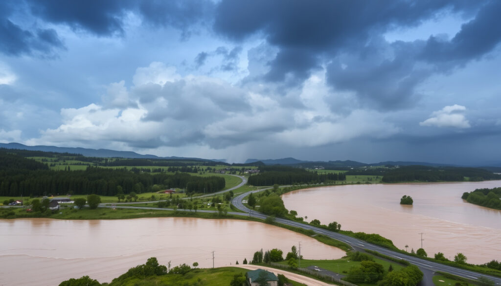
If you live in Rotorua or Tauranga, you’ve probably been watching the rain radar closely this week. A 40-hour heavy rain warning had forecast intense downpours, but the actual totals so far tell a more measured story.
Tauranga rain recorded so far (Mar 26): fraction of predicted 40-hour total ·
Rotorua rain recorded (Mar 26): 8.6mm of predicted 48.4mm ·
Heavy rain warning level: Red warning lifted; Heavy Rain Watches continue for Westland and Tararua ·
Affected region: Bay of Plenty, including Rotorua and Tauranga
Quick snapshot
- Red warning lifted as of Mar 26 (Western Bay of Plenty District Council)
- Heavy Rain Watches for Westland and Tararua (Western Bay of Plenty District Council)
Seven key figures stand out from the official data, one pattern: the gap between forecast and observed rainfall is significant, especially in Rotorua.
The table below lays out the key numbers from this event.
| Metric | Value |
|---|---|
| Warning level | Red Heavy Rain Warning lifted; Heavy Rain Watches remain (Western Bay of Plenty District Council) |
| Event duration | 40-hour heavy rain warning (NZ Herald) |
| Tauranga predicted total | Not specified publicly; actual below prediction (NZ Herald) |
| Rotorua predicted total Mar 26 | 48.4mm (Radio 1XX) |
| Rotorua recorded total Mar 26 | 8.6mm (Radio 1XX) |
| Matatā 24h rainfall (nearby) | 182mm (Radio 1XX, citing Bay of Plenty Regional Council) |
| Tarawera 24h rainfall | 120mm (Radio 1XX) |
| Kawerau 24h rainfall | 110mm (Radio 1XX) |
| Weekly totals (most of Bay of Plenty) | 100–200mm (NIWA) |
| Weekly totals (Rotorua/east) | 30–50mm (NIWA) |
| Tauranga current temp | 6.1°C feels like 5°C (Radio 1XX) |
| Rotorua current temp | 3.6°C feels like 1°C (Radio 1XX) |
The implication: the system delivered intense rain in pockets but left the main urban centres drier than forecast.
Why is it raining so much in New Zealand right now?
La Niña influence
- Persistent low-pressure systems are driving moisture-laden air from the subtropics over the North Island (NIWA (national climate research institute)).
- A La Niña pattern has been active, favouring above-normal rainfall for northern and eastern areas of New Zealand.
Subtropical moisture flows
- A deep trough interacting with warm sea-surface temperatures north of the country has fed a conveyor belt of moisture into the Bay of Plenty (NZ Herald (major national news outlet)).
- MetService forecasts peak rain rates of 15 to 20 mm/h, increasing to 25 to 40 mm/h from early Friday morning (Western Bay of Plenty District Council).
The same weather system that brought record weekly totals to some parts of the Bay of Plenty – 182mm at Matatā – has so far delivered only a fraction of that to Rotorua and Tauranga, creating a sharp local contrast.
What is the red warning in New Zealand?
MetService warning levels explained
- Red is the highest alert for dangerous weather, reserved for events expected to cause significant disruption and risk to life (Western Bay of Plenty District Council).
- Orange warnings indicate moderate to heavy rain that may cause flooding and disruption, but with lower risk than red.
Red warning vs orange warning
- For the current event, MetService initially issued an orange warning for Bay of Plenty west of Whakatāne, spanning 29 hours from 8pm Thursday 26 March to 1am Saturday 28 March (Western Bay of Plenty District Council).
- There was a high chance the orange warning could be upgraded to red (Western Bay of Plenty District Council).
- A red warning was eventually issued for parts of the region, but it was later lifted (Radio 1XX (local radio station)).
The council still warns of a moderate chance of localised downpours of 25 to 40 mm/h, which could trigger a new red warning if they materialise (Radio 1XX).
The pattern: despite the red warning being lifted, the risk of severe localised flooding remains active.
Is it going to rain in Tauranga today?
48-hour rain radar Tauranga
- Radar imagery shows active bands moving across the western Bay of Plenty, with the heaviest showers currently near Tauranga (Radio 1XX).
- MetService expects another 50 to 80 mm of rain on top of what has already fallen, according to the same warning (Radio 1XX).
MetService Tauranga forecast
- Today’s recorded rainfall is still well below the predicted high-end of the 40-hour total (NZ Herald).
- Temperatures remain cold: Tauranga is at 6.1°C (feels like 5°C), Rotorua at 3.6°C (feels like 1°C) (Radio 1XX).
While the 40-hour warning predicted a severe deluge, the actual rainfall in Rotorua and Tauranga has been modest – 8.6mm vs 48.4mm predicted for Rotorua. Yet nearby Matatā saw 182mm in 24 hours, proving the system’s potential is very real.
Timeline signal
- March 25–26, 2026: 40-hour heavy rain warning issued for Bay of Plenty; Red warning active (Western Bay of Plenty District Council)
- January 22, 2025: Red Heavy Rain Warning for Bay of Plenty including Rotorua (historical reference) (Newstalk ZB (national radio network))
- 1968: Cyclone Giselle caused Wahine disaster, worst storm in NZ history
- Ongoing: La Niña pattern bringing persistent rain to northern NZ (NIWA)
What is clear and what isn’t
Confirmed facts
- Red warning for Bay of Plenty lifted by MetService (Western Bay of Plenty District Council)
- Rotorua recorded 8.6mm against predicted 48.4mm (Radio 1XX)
- Heavy Rain Watches active for Westland and Tararua (Newstalk ZB)
- 182mm recorded at Matatā in 24 hours (Radio 1XX)
What’s unclear
- Total Tauranga rainfall for the 40-hour event (NZ Herald)
- When the next heavy rain band will arrive (Radio 1XX)
- Whether the orange warning will be upgraded to red again (Western Bay of Plenty District Council)
Voices from the event
“There is still a high chance the orange warning could be upgraded to a red warning.”
— Western Bay of Plenty District Council, in a statement to residents (Western Bay of Plenty District Council)
“The 42-hour deluge forecast triggered monitoring across the Bay of Plenty.”
— NZ Herald reporter, describing the scale of the warning (NZ Herald)
“A severe thunderstorm warning affecting the Bay of Plenty and Rotorua was lifted after running from 8:34am to 11:00pm on 26 March 2026.”
— Radio 1XX, quoting MetService (Radio 1XX)
The gap between predicted and recorded rainfall in Rotorua and Tauranga is a reminder that weather forecasts, even with advanced models, can overestimate the intensity of a system. But the 182mm that fell at Matatā shows the potential for flash flooding remains. For residents of Tauranga and Rotorua, the smart move is to keep the radar on and stay informed – the next band could bring the deluge the warning promised.
youtube.com, rova.nz, facebook.com, nzherald.co.nz, metservice.com, rnz.co.nz, easeweather.com
Frequently asked questions
Where can I check the live rain radar for Tauranga?
MetService’s weather radar covers the Bay of Plenty region. You can view it on the MetService website or through the NIWA Hotspot Watch (NIWA).
How do MetService red warnings work?
Red is the highest alert level, issued when dangerous weather is expected to cause significant disruption and risk to life. It triggers emergency response plans and public safety messages (Western Bay of Plenty District Council).
What should I do during a red heavy rain warning?
Avoid travel, stay indoors, and move to higher ground if flooding is imminent. Follow instructions from local civil defence authorities (Western Bay of Plenty District Council).
Is Rotorua expected to get more rain than Tauranga?
Both cities are under the same warning system, but the forecast suggested Rotorua would see around 48.4mm on March 26 compared to Tauranga’s higher potential totals. Actual recorded amounts have been lower in both (Radio 1XX).
What is the historical wettest day for Tauranga?
Tauranga’s wettest day on record is 161.6mm, set in 1968 during Cyclone Giselle (the same storm that caused the Wahine disaster). The current event is far below that record (Newstalk ZB).
How does this event compare to Cyclone Giselle?
Cyclone Giselle in 1968 remains the most costly storm in New Zealand history, causing the Wahine shipwreck and widespread devastation. The current event is much smaller in scale, though localised flooding is possible (Newstalk ZB).
More related posts
 NZ Take Home Pay Calculator: Calculate Your Net Salary in 2026
 Mission Heights Primary School: Principal, Enrollment, Decile
 Race of Champions 2025: Results, Format, and How to Watch
 Wellington Phoenix vs Auckland FC Tickets: Prices & Buy Guide
 Antonov An-124 – Specifications History and Operations
 Millie Moon Nappies NZ: Guide, Prices & Comparison
 Jacqui and Clint MAFS: Still Together? Wedding & Updates
 Signs of Liver Disease: Early Symptoms & Warning Signs